  Time:     8 hours
  Distance: 18.3 km (11.4 miles)
  Ascent:   1060m (3400 feet)
  Lowest:   3340m (11000 feet)
  Highest:  4400m (14400 feet)
  Terrain:  Rocky paths with loose stones
  View route in Google Maps
This walk from Palcamayo follows part of the Big Inca Road, the Qhapaq Ñan, as it leaves Palcamayo, climbing up through the fascinating and beautiful Canchapata Canyon, passing through various different areas of natural vegetation, wildlife and geology. Arriving at the high glacial valley of Cauquirán, some impressive mountains come into view and an area of small lakes. Climbing up past the Mamancocha lake, over the pass above Cocón, a descent is made to the Pampa of Ricricán before visiting the ruins of Auqis Aypal and returning to Palcamayo.
This is for strong walkers who are acclimatised to the altitude! I did this walk with a local (Paco, my brother-in-law) who knows these mountains from his childhood, and it took us 8 hours. Starting early is recommended to avoid being rushed as evening comes on. The route passes through various communities, so in case of difficulty it should be possible to find help or somewhere to shelter. We did the walk in the dry season, but in the rainy season (February) everything would be green!
You can follow the descriptions with the thumbnails on this page, or alternatively click on any image and go through the large pictures one by one.
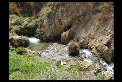 | From Palcamayo, we walk up the road towards Huagapo Cave alongside the Rio Shaca. This is a place on the river where there are some rapids and falls. |
 | Eventually we reach Ushto, where the track leads off to the right to climb up into the Canchapata Canyon, following the route of the Inca Road, the Qhapaq Ñan. |
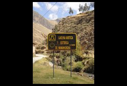 | Here is the sign at the junction to turn off to Canchapata Canyon. |
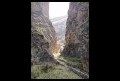
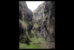
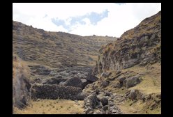
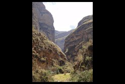 | This is the entrance to the Canchapata Canyon (also called the Ushto Canyon). |
 | A little further up the Canchapata Canyon. The canyon twists and turns as it rises steadily. |
 | There are parts where the Canchapata Canyon widens slightly and there are cultived fields and plenty of wildlife -- even hummingbirds. |
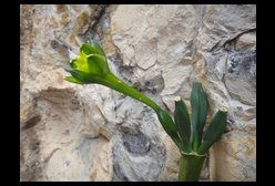 | Here is a green flower which the hummingbirds like, which seems related to a daffodil. |
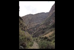
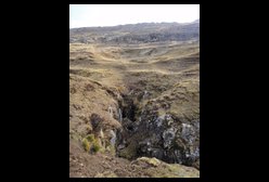
 | The Canchapata Canyon narrows. We pass through different layers of rock as we get higher. The geology is very evident in the canyon walls. |
 | In this part of the Canchapata Canyon there are a lot of hanging plants. |
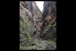
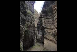 | Looking back down the Canchapata Canyon at its narrowest point. This part is called "Escalón". |
 | Higher up still, the canyon opens out a bit, before closing in again. This is the view looking back down. |
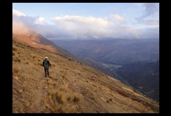
 | We're getting quite high now. Looking back here we see impressive cliffs above. |
 | The rock changes once again as we leave the Canchapata Canyon and arrive at Milpo. |
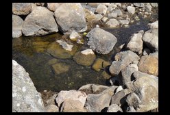
 | This is a sink-hole in the river bed. The river that thousands of years ago cut the Canchapata Canyon now disappears into this sink-hole, and probably contributes to the outflow from the Huagapo Cave. Right now it is the dry season so there is no water. Occasionally, though, during the rainy season the water overflows and runs down the canyon. This happened 5 years ago. |
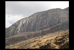 | The rocks on the cliffs above Milpo look like knives. |
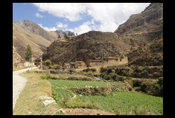
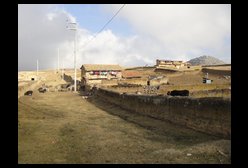
 | A little bit higher we arrive at the village of Cauquirán. |
 | Here is Cauquirán's little school (painted green), and we catch our first glimpse of the impressive mountains behind. |
 | Here they're producing Tocosh (or Togosh). A hole is dug in the river, which is filled with potatoes and then covered with straw. The potatoes are left for 6 months or more. After this time, they are soft and mouldy with a strong smell, and are renowned as a natural antibiotic. |
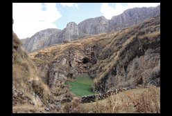
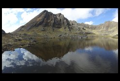
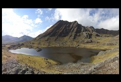
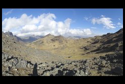
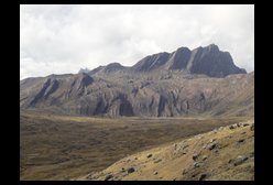 | We follow the valley around from Cauquirán, and then climb up to a small hanging valley on the right where there is a small settlement. From here there is a good view of the Cauquirán Lake, and the impressive mountains behind. |
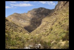
 | A wider view of the glacial valley above Cauquirán. The Inca Road (Qhapaq Ñan) continues up this valley to the left of the large mountain, before crossing the highlands and arriving at Junin. |
 | Climbing higher up the small hanging valley above Cauquirán, we arrive at the Mamancocha Lake. |
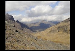
 | We then head up shepherd tracks on the right side of the Mamancocha Lake to the pass there. This is a view back down to the lake. |
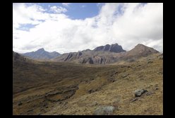
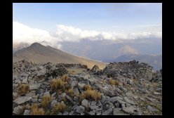
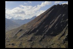 | A view back of all the mountains sticking up at the same angle, far into the distance, above Mamancocha. |
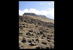 | A view towards the right as we approach the top of the pass above Mamancocha. |
 | Here we reach the top of the pass, the highest point of the walk at 4400m. Down towards the left, the valley leads to Cocón. Instead we follow the mountain around to the right to the pass over to the Pampa of Ricricán. |
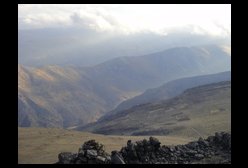
 | Looking down towards Cocón from the pass towards Ricricán. |
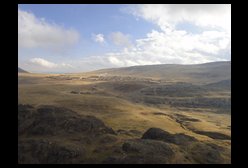
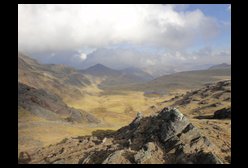 | At the top of the pass looking down on the Pampa of Ricricán. |
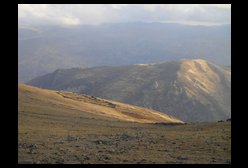
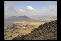 | Looking across the pampa to Ricricán on the right, and the ruins of Auqis Aypal on the nearby peak. |
 | A better view of Ricricán. |
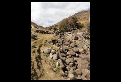
 | Down in the dip before the town of Ricricán is another sink-hole. |
 | We pass through Ricricán on our way to the ruins of Auqis Aypal |
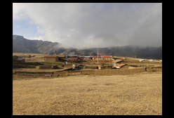 | Looking back on Ricricán's school |
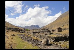
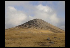 | We approach the ruins of Auqis Aypal. |
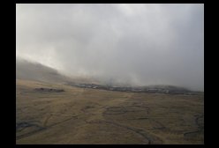 | From the ruins of Auqis Aypal, looking back at Ricricán. The clouds are closing in as the day is getting late. |
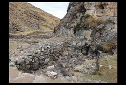
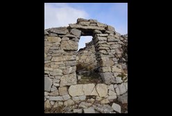 | One of the better preserved houses in the ruins of Auqis Aypal. All the houses are round, whereas the tombs are often rectangular buildings. |
 | To the left, the wall enclosing the central part of the ruins of Auqis Aypal. |
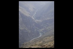
 | Looking down from the ruins of Auqis Aypal towards Palcamayo, which is just visible below. |
 | Looking down from Auqis Aypal to the valley containing Huagapo Cave and the road to San Pedro de Cajas. |
 | Looking across from Auqis Aypal to the other side of the valley, with the ruins of Ticlán on the left end of the ridge, and a place named "Call the Condor" on the right. |
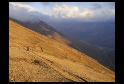 | We go straight down from the high pampas until we reach fields, and then find a descending zig-zag path to take us to the valley below. Palcamayo is visible on the far right. |
 | The evening is drawing in, but we are on a good path down. We eventually emerge beside the trout farm in the valley below. |
 | A final view down to Ushto (below centre in the picture) where we started the climb up Canchapata Canyon, and of the road continuing up to Huagapo Cave and on to San Pedro de Cajas. |