  Time:     9 hours
  Distance: 28 km (17.4 miles)
  Ascent:   400m (1300 feet)
  Descent:  1060m (3500 feet)
  Starting: 4040m (13300 feet)
  Highest:  4400m (14400 feet)
  Ending:   3340m (11000 feet)
  Terrain:  Roads, grass tracks, rocky paths with loose stones
  View route in Google Maps (switch to satellite view!)
This is a long walk across the glacial highlands north-west of Palcamayo. The walk starts in San Pedro de Cajas, a 45-minute collectivo taxi ride away. San Pedro is 700m higher than Palcamayo, which means that the walk is more downhill than uphill, although there is a 400m climb and various smaller climbs along the route. The route first follows a glacial valley up to a large lake which is the source of the main river that flows through Palcamayo. It then crosses a high pampa area of lakes and grazing land, following around the edge of a massif of white rock, before joining part of the Inca Road as it goes through a more spectacular mountain area formed from the layers of distinctive brown and red rocks. It follows the Inca route (more or less) back to Palcamayo, finally descending through the Canchapata Canyon.
When I did this walk I didn't know the exact route of the Inca Road, so I followed the boundary between the red and white rock layers instead. Probably it would be faster and easier to follow the Inca Road. You'd need to find your own landmarks if you want to try that route, though.
There are lots of areas alongside this route which I'd like to explore more -- it almost seems like a playground of weird and wonderful mountain peaks and strange large-scale geological formations. Doing this walk with a geologist would likely be fascinating -- there must be at least 5 different rock types in clear layers stacked at about 45 degrees, and also the evidence from glaciation and other distinctive formations such as sink-holes.
Again this is for strong walkers. Probably you wouldn't even get to the first lake without being acclimatised to the altitude, and it is a long day to do the whole route. A road follows most of the route, so with a friend in a car to drop you off, you could make it much shorter.
You can follow the descriptions with the thumbnails on this page, or alternatively click on any image and go through the large pictures one by one.
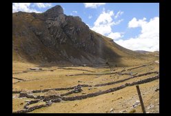
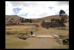 | From Palcamayo, first you need to catch a colectivo taxi up to San Pedro de Cajas (45 minutes). The road follows the river up the valley (past Huagapo Cave) before zig-zagging up to the left away from the river. On arriving at San Pedro, we have to return to this river, which is now the other side of a low hill towards the right on entering San Pedro. From the plaza, leave on the right hand side, heading across the valley towards the low hills there. You'll cross a small stream (shown here in the picture), and then head straight up and over the hill beyond. |
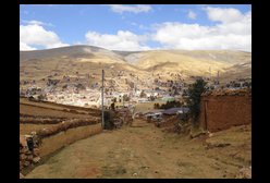 | Looking back on San Pedro. The road from Palcamayo enters on the left of the photo. |
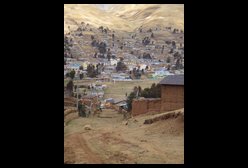 | Close-up looking back down on San Pedro main square, and the track we are on which leads up from one corner of it. |
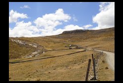
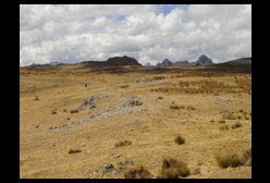
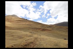 | On reaching the brow of the hill, we follow the widest sheep track around the hill to the left. |
 | Looking down the river valley towards Palcamayo |
 | We continue following the sheep track around the hill. |
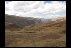
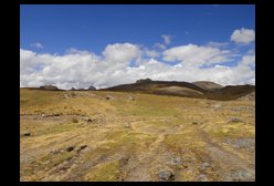
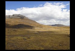
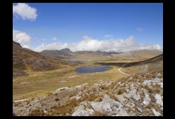
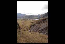
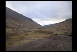
 | Here we see the main river valley that we wish to follow. The sheep track joins the white road at the kink. Also note the waterfalls on the right. We will now follow this river all the way up to its source, which is a large lake. We can follow the white road most of the way. |
 | Walking up the valley, following the white road. This is a classic glacial valley. |
 | The land here is actively used for sheep and cows. The shepherds stay in these little 'chosas' when they are up on the mountain. |
 | Approaching the final climb towards the lake. The white sandy rock marks the edge of the lake. You can cut off a zig-zag by following the grassy path up. |
 | Looking back down the valley. You have two choices here, either to follow the road to the lake edge, or to cut right to a nearby hillock to get a view from above instead. |
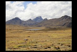
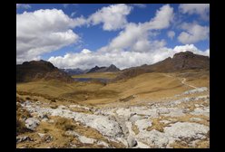
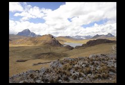
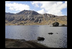
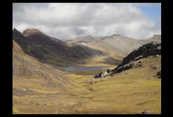
 | The lake which is the source of the river that descends to Palcamayo, and the mountains behind it. From here we turn right and follow around the edge of the highland massif made of white rock, keeping it on our right hand side, but not ascending into it, nor descending into any of its valleys. It is possible to follow the white road, or alternatively cut across on sheep herding paths. |
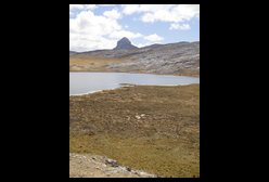 | Closer view of the strange mountain peak and the lake in the foreground. |
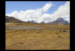 | Following the sheep track along the edge of the massif, we can look across another lake to the road beyond (in white) and the mountains beyond. |
 | Close up of some of the large black and white birds on the lake. |
 | View across yet another lake as we follow the sheep path. |
 | We use the sharp peaks in the distance as a guide. There is an old lady coming the other way who confirms that I'm on the right path. |
 | Here there is a fork. Towards the right there is a descent to Yaunipuquio. We follow the left fork towards the more interesting mountains in the distance. |
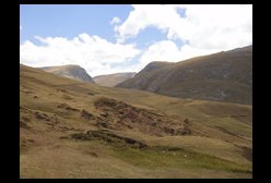
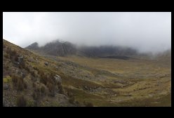
 | Yet another lake and more impressive mountain peaks. |
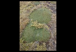 | Apart from grass, there are also large mats of this short-leafed plant. Some areas are completely covered with it. |
 | Looking back the way we've come, back towards the large lake at the head of the river and the hilltop at the head of the glacial valley. |
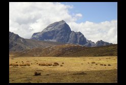 | Another view of one of the impressive peaks. |
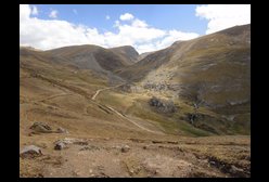
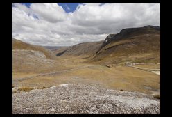
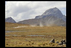
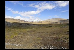
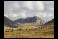
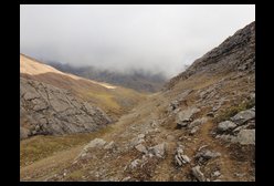
 | Eventually the track arrives at a ridge overlooking an area of spiky mountains formed of a different type of rock. We also rejoin the road. From here we turn right and the aim is to follow the join between the red and white rocks, which will eventually lead us to the valley above Cauquirán. |
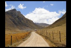
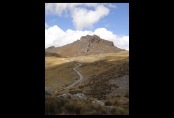 | We can follow the road over the ridge. |
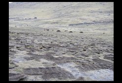
 | Looking back, you can see the strange rock formations and water features. This boggy area appears to empty both into a sink-hole and also into the lake. |
 | Looking down on the road and the valley beyond. Instead of following the road (which winds a lot), it is also possible to follow the trail alongside the reddish rocks on the left side of the valley, which is the original Inca Road (Qhapaq Ñan) that passes up from Palcamayo. From here you can see the white road snaking across the valley and passing the three lakes, which is also where the Inca Road passes (although more directly, as it was designed for runners, not cars). Apparently this is a better route to reach the head of the Cauquirán valley, but as I didn't know that, instead I followed the join between the two types of rock, which at least guaranteed that I wouldn't get lost. |
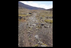 | Here is a part of the Inca Road (Qhapaq Ñan) where you can still see the paving. |
 | Here is another part of the original Inca Road (Qhapaq Ñan). |
 | One of the lakes on the route. |
 | We head to the pass in the distance (where the red and white rocks meet), but curve around to the left to avoid crossing a valley. |
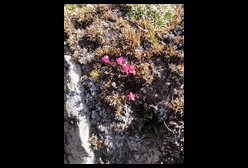 | A small red flower. |
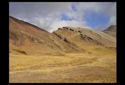
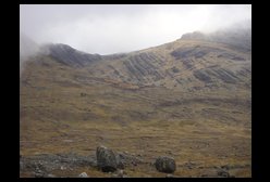
 | Looking toward the right, you can see the line of distinctive white cliffs which lower down form the boundary on one side of the Canchapata Canyon. Instead of descending here, we continue following the join between the red and white rocks. |
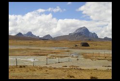
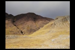
 | Following the join between the red and white rocks, we arrive at this outcrop with enclosures for the sheep. |
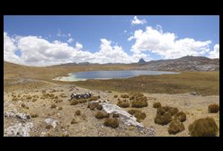
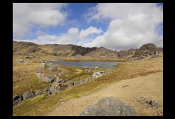 | This lake is alongside it. |
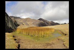 | On the other side of the ridge is this reed bed. |
 | From here there is a view of another lake, and far below another lake which is where we are heading to. Above that lower lake you can see the clearest join yet between the red and white, which is where we will cross over into the Cauquirán valley. |
 | The lake below, and just visible are the zig-zag sheep paths climbing to the right of the red-white join. On the other side of that ridge is the Cauquirán valley. |
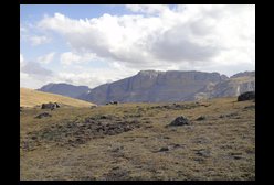
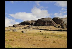
 | Looking right there is another part of the line of white-rock cliffs, and on the left end there are what appear to be ruins of a settlement. |
 | Here is the final climb to pass over the ridge. |
 | Another view of the join between the rocks, from the side. |
 | Looking back, we came down that pass in the distance, beyond the lake. |
 | Finally we reach the other side. From here it is downhill all the way to Palcamayo, following first the river and then the path down through the Canchapata Canyon. Instead of heading straight down, I head left across the rock face to get a better view of the Cauquirán valley. |
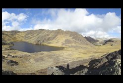
 | This is the lake at the head of the valley of Cauquiran. The valley leads off down to the right. From what I've heard, the Inca Road (Qhapaq Ñan) comes over the pass to the left. This may be an easier route, but I can't provide directions until I've tried it. |
 | Looking across the valley, here is the settlement at the edge of the hanging valley which contains Mamancocha Lake. In walk 2, we crossed the ridge behind the lake to reach the top of the valley above Cocón and the Pampa of Ricricán. |
 | The valley down towards Cauquirán and the way back home. |
 | In the valley, here they have been cutting turf and drying it in piles ready to use as fuel. |
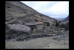 | The last houses in Cauquirán. It is getting late, and the sheep are all back home (in the enclosure to the left). It is another hour's walk down through the Canchapata Canyon (see walk 2), and then following the road back to Palcamayo. Unfortunately I left this a bit late, but I had a torch so could return safely. |